lume, Atlas - Lume; Jollain - Trésor des cartes géographiques des principaux estatz de l'univers - 1667
Nr. 85295597

Nr. 85295597
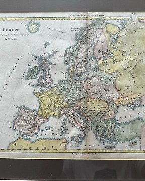
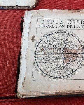
"Mappe-Monde"
Hand-coloured copper-engraved map by Robert de Vaugondy on the Mercator projection. Derived from "Nouvel Atlas Portatif destine principalement pour l'instruction de la Jeunesse" or ("A New Portable Atlas Designed Primarily for the Instruction of Youth"). With original outline color showing the territories associated with the four major world religions: Christianity, Islam, Judaism and Paganism. Attractive cartography reflects the latest discoveries of explorers of the late 18th century.
Dimensions
45 cm x 32 cm
Artist or Maker
Robert de Vaugondy
Medium
Copper engraving
Date
1806
Condition Report
This work is in good condition overall. Please review the images carefully for condition and contact us with any questions.
This item is professionally protected by handmade packing.
The Certificate of Authenticity is included.
Dimensions
24 cm x 38 cm
Artist or Maker
Charles François Delamarche
Medium
Copper engraving
Date
1805
Condition Report
This work is in good condition overall. Please review the images carefully for condition and contact us with any questions.
This item is professionally protected by handmade packing.
The Certificate of Authenticity is included.
Cum să cumperi de la Catawiki
1. Descoperă ceva special
2. Plasează cea mai mare ofertă
3. Fă o plată sigură