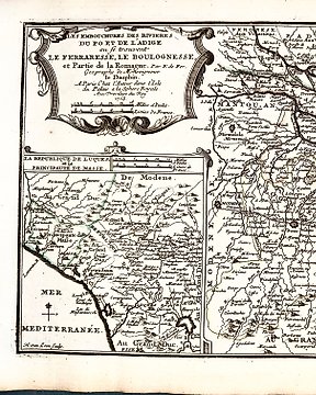
Nr. 74992485

Solgt
Europa, Ukraine / Ratney / Volyn Oblast / Carpathian Mountains / Poland; Nicolas Sanson (1600-1667) - "Russie Noire" - 1661-1680
Siste bud
€ 500
48 uker siden

Europa, Ukraine / Ratney / Volyn Oblast / Carpathian Mountains / Poland; Nicolas Sanson (1600-1667) - "Russie Noire" - 1661-1680

Original hand-color in outline, detailed map of "Russie Noire", created from the maps of Guillaume Levasseur de Beauplan, published by Nicolas Sanson. The map extends from the Carpathian Mountains to Lublin (Poland) in the northwest and Ratney in Volyn Oblast of Ukraine. The map tracks the southern part of the modern Poland - Ukraine Border. In a competitive race with the publishing house of the Blaeu brothers, Nicolas Sanson decided to expand the works of Beauplan by dividing his "Special Map of Ukraine" into five separate maps of Ukrainian voivodeships. All five maps, as noted by many researchers, exhibit a relatively moderate level of cartographic accuracy and quality. Sanson was not meticulous about details. However, in each of the five map sheets, he refers to "The General Map of Ukraine" by Guillaume Levasseur de Beauplan. Despite the geographical inaccuracies of certain map elements that arose from the actual copying of Beauplan's works, Sanson's publishing house excelled in the artistic design of all five maps: they feature delicately carved and beautifully adorned floral ornaments and classical themes. The original colorized versions of those maps that have survived captivate with their charm. Nicholas Sanson (1600-1667) is considered the father of French cartography in its golden age from the mid-seventeenth century to the mid-eighteenth. Over the course of his career he produced over 300 maps; they are known for their clean style and extensive research. Sanson was largely responsible for beginning the shift of cartographic production and excellence from Amsterdam to Paris in the later-seventeenth century. Beauplan was a French geographer and military engineer who went to Poland at the invitation of King Sigismund III and spent 17 years building fortresses and castles as well as surveying parts of Ukraine. In 1639, he participated in a surveying expedition down the river Dnieper. About this time he drew a sketch map of southern Ukraine, the “Tabula geographica Ukrainska.” Dimensions: 23” x 18” inches / 59 cm x 46 cm Medium: Engraving Date: 1665 Artist: Nicolas Sanson Place: Paris, France The work is in very good condition overall. There may be a few minor imperfections or fox or mottled marks to be expected with age. Please review the image carefully for condition and contact us with any questions. This Item is professionally protected by handmade packing.

Nr. 74992485

Solgt
Europa, Ukraine / Ratney / Volyn Oblast / Carpathian Mountains / Poland; Nicolas Sanson (1600-1667) - "Russie Noire" - 1661-1680

Europa, Ukraine / Ratney / Volyn Oblast / Carpathian Mountains / Poland; Nicolas Sanson (1600-1667) - "Russie Noire" - 1661-1680

Original hand-color in outline, detailed map of "Russie Noire", created from the maps of Guillaume Levasseur de Beauplan, published by Nicolas Sanson. The map extends from the Carpathian Mountains to Lublin (Poland) in the northwest and Ratney in Volyn Oblast of Ukraine. The map tracks the southern part of the modern Poland - Ukraine Border. In a competitive race with the publishing house of the Blaeu brothers, Nicolas Sanson decided to expand the works of Beauplan by dividing his "Special Map of Ukraine" into five separate maps of Ukrainian voivodeships. All five maps, as noted by many researchers, exhibit a relatively moderate level of cartographic accuracy and quality. Sanson was not meticulous about details. However, in each of the five map sheets, he refers to "The General Map of Ukraine" by Guillaume Levasseur de Beauplan. Despite the geographical inaccuracies of certain map elements that arose from the actual copying of Beauplan's works, Sanson's publishing house excelled in the artistic design of all five maps: they feature delicately carved and beautifully adorned floral ornaments and classical themes. The original colorized versions of those maps that have survived captivate with their charm. Nicholas Sanson (1600-1667) is considered the father of French cartography in its golden age from the mid-seventeenth century to the mid-eighteenth. Over the course of his career he produced over 300 maps; they are known for their clean style and extensive research. Sanson was largely responsible for beginning the shift of cartographic production and excellence from Amsterdam to Paris in the later-seventeenth century. Beauplan was a French geographer and military engineer who went to Poland at the invitation of King Sigismund III and spent 17 years building fortresses and castles as well as surveying parts of Ukraine. In 1639, he participated in a surveying expedition down the river Dnieper. About this time he drew a sketch map of southern Ukraine, the “Tabula geographica Ukrainska.”

Dimensions: 23” x 18” inches / 59 cm x 46 cm
Medium: Engraving
Date: 1665
Artist: Nicolas Sanson
Place: Paris, France

The work is in very good condition overall. There may be a few minor imperfections or fox or mottled marks to be expected with age. Please review the image carefully for condition and contact us with any questions.

This Item is professionally protected by handmade packing.

Legg inn et søkevarsel
Angi et søkevarsel for å bli varslet når nye treff er tilgjengelige.

Dette objektet ble vist i


Hvordan kjøpe på Catawiki

Les mer om vår kjøperbeskyttelse

      1. Oppdag noe spesielt

      Bla gjennom tusenvis av spesielle objekter valgt av eksperter. Se bilder, detaljer og estimert verdi av hvert spesialobjekt. 

      2. Legg inn det høyeste budet

      Finn noe du liker, og legg inn det øverste budet. Du kan følge auksjonen til slutten eller la systemet vårt gjøre budgivningen for deg. Alt du trenger å gjøre er å angi et bud for det maksimale beløpet du vil betale. 

      3. Å gjøre en sikker betaling

      Betal for dine spesielle objekter og vi holder betalingen sikker til objektet ditt kommer trygt og godt frem. Vi bruker et pålitelig betalingssystem for å håndtere alle transaksjoner. 

Har du noe lignende å selge?

Enten du er ny på nettauksjoner eller profesjonell selger, kan vi hjelpe deg med å tjene mer for dine spesielle gjenstander.

Selg objektet ditt