Catawiki actualiza constantemente su tecnología. Actualmente, estás utilizando un navegador obsoleto. Para optimizar tu experiencia de navegación, actualiza tu navegador.
Cookies
Puedes configurar tus preferencias de cookies utilizando los botones de abajo. Puedes actualizar tus preferencias, retirar tu consentimiento en cualquier momento y ver una descripción detallada de los tipos de cookies que usamos nosotros y nuestros socios en nuestra Política de cookies.
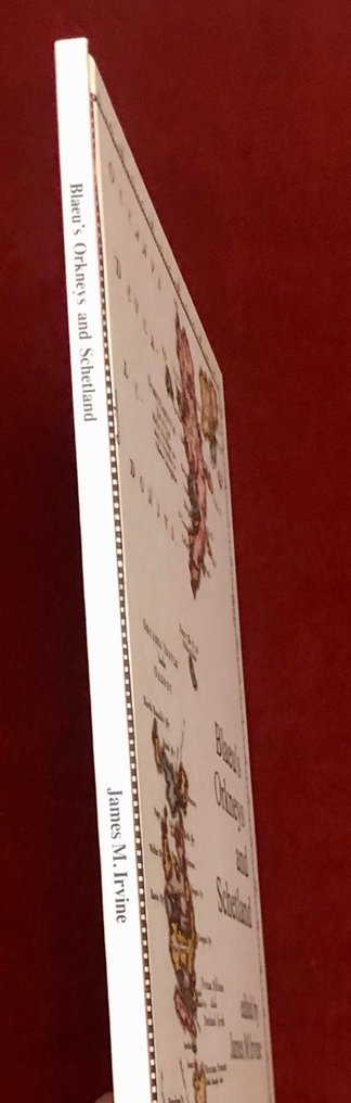
Timothy Pont - The Orkneys and Schetland in Blaeu's Atlas Novus of 1654 - 2006
The Orkneys and Schetland in Blaeu's Atlas Novus of 1654. The map of Timothy Pont and the New Descriptions of Walter Stewart, as translated by Ian Cunningham. 10 plates, 8 of which are col. maps. Illustrated board cover. "The fifth volume of Joanne Blaeu's Atlas Novus was the first comprehensive atlas of Scotland . This volume reproduces the map and the translated descriptions of Orkney and Shetland with editorial footnotes, and explores their provenance, reliability and local significance.
The Orkneys and Schetland in Blaeu's Atlas Novus of 1654. The map of Timothy Pont and the New Descriptions of Walter Stewart, as translated by Ian Cunningham. 10 plates, 8 of which are col. maps. Illustrated board cover. "The fifth volume of Joanne Blaeu's Atlas Novus was the first comprehensive atlas of Scotland . This volume reproduces the map and the translated descriptions of Orkney and Shetland with editorial footnotes, and explores their provenance, reliability and local significance.
Número de libros
1
Tema
Geografía, Topografía (geografía)
Título del libro
The Orkneys and Schetland in Blaeu's Atlas Novus of 1654